Remember when driving was a pleasure, when the simple act of rolling down the highway was considered a form of relaxation? Texans’ historic love affair with the highway has been tested by congestion, gridlock and other realities of 21st-century motoring. Navigating the freeways of Texas cities these days just isn’t any fun.
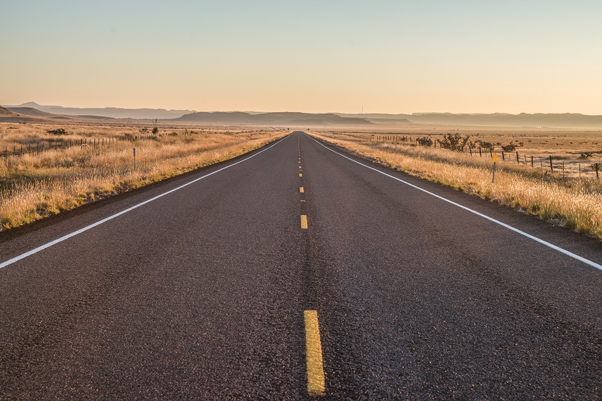
But go far enough west—about 50 miles beyond Interstate 35 and the 98th meridian, where the humans and vehicular traffic thin out—and driving can become a pleasure again. Here in the wide-open spaces, you can chase two-lane blacktop to remote dots on the map; to where the landscape empties out and turns abstract, boiling down to earth, sky and horizon; to where it gets lonely enough that the sight of another car, pickup or tractor-trailer coming from the other direction reflexively inspires the index finger to lift off the steering wheel in a silent “hidy” as it passes.
Bring along some Texas driving tunes, such as Robert Earl Keen’s The Road Goes On Forever, Townes Van Zandt’s White Freightliner Blues and Blind Leon Payne’s Lost Highway, and you’re set. A West Texas road trip is a vacation unto itself. The destination is almost beside the point.
But if you’re one of those travelers who needs to know where you’re going, I recommend the Panhandle and the Big Bend as endpoints. The Camino del Rio, the River Road, officially labeled FM 170, is the most scenic drive in Texas. Shadowing the Rio Grande for 50 miles between Lajitas and Presidio, the winding road reveals spectacular views with every twist and curve and rise and drop.
The rugged mountain country is largely devoid of vegetation, infusing the landscape with an otherworldly aura. There are no services along the Camino, and driving the road at night is not recommended. This land is open grazing land, and cattle apparently like to congregate on the pavement after dark. In daylight, there isn’t a better highway to mosey along.
The lure of the Texas Panhandle, more than 400 miles north of the Big Bend, is an excellent road grid with next to no congestion outside of Amarillo. The drives north of Amarillo, to Canadian, Perryton and Dumas, or those south and southeast of Amarillo through Palo Duro Canyon, cut through gently rolling plains with occasional outcroppings that hint at the Rocky Mountains looming to the west and north. With destinations that include Palo Duro Canyon State Park, the Panhandle-Plains Historical Museum in Canyon, the Alibates Flint Quarries National Monument northeast of Amarillo and Adobe Walls historic site east of Stinnett, you can devise your own survey of the American West.
The Panhandle also is home to a portion of Route 66, America’s most historic highway. Running through Texas for 179 miles between Shamrock and Glenrio, Route 66 was replaced long ago by the less poetic Interstate 40. But enough stretches of the original Route 66 remain, with a barbed wire museum, leaning water tower, skyscraping cross, vintage motels, highway cafés and miscellaneous roadside attractions to draw a steady stream of pilgrims chasing their version of the American dream. These tourists dress midcentury modern in T-shirts, jeans and poodle skirts as they cruise the Mother Road in vintage cars, motorcycles and RVs.
Roughly linking the Panhandle and the Big Bend is the Texas Forts Trail, mapped out by the Texas Historical Commission and the Texas Department of Transportation. The trail connects historic forts located along a line between Wichita Falls and Del Rio. Each fort tells its own stories involving soldiers, settlers and natives during the decades from Texas’ entry into the United States to the forced removal of indigenous tribes.
Fort Griffin, Fort Richardson, Fort McKavett and Fort Lancaster are state historical sites. Fort Concho in downtown San Angelo is a national historic landmark owned and operated by the city. Fort Stockton, Fort Phantom Hill and Fort Chadbourne also are under local stewardship. I am partial to Fort Lancaster, south of Interstate 10 and east of Sheffield, which is at the start of a route (Texas 349, Ranch Road 2400 and U.S. 285) that passes through majestic canyons on the way to Sanderson and the Big Bend.
Overcrowding, often the case at other tourist sites, is not an issue at Texas’ historic forts.
Overcrowding isn’t an issue on West Texas roads, either, as long as you steer clear of the trucks, potholes and traffic in the Permian Basin oil patch. Out west in Texas, the road really does go on forever, and the pleasure of driving never ends.
Writer Joe Nick Patoski loves driving West Texas as much as he loves cool swimming holes, hot music and cold beer. His latest book is Austin to ATX: The Hippies, Pickers, Slackers & Geeks Who Transformed the Capital of Texas (Texas A&M University Press, 2019). He lives outside Wimberley and is a member of Pedernales Electric Cooperative.